Onderdeel: MIDDEN-EUROPA (AT B 50-79)
<< | Hoofdpagina | Contact | >>
Onderdeel: MIDDEN-EUROPA (AT B 50-79) |
<< | Hoofdpagina | Contact | >> |
| B 50 | Burgenland Straße: Abzweigung von der B 9 nächst Berg-Parndorf-Eisenstadt-Mattersburg-Oberpullendorf-Oberwart-Hartberg |
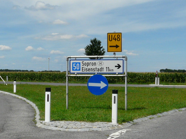 | 1.
Foto gemaakt in augustus 2016 P1260297x50 Op de foto: 50 ⇈top⇈ |
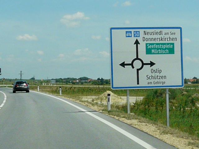
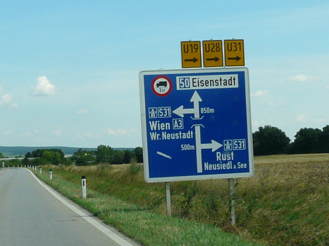 | 2.
Foto gemaakt in augustus 2016 P1260301x50s31a3 Op de foto: 50 S31 A3 ⇈top⇈ |
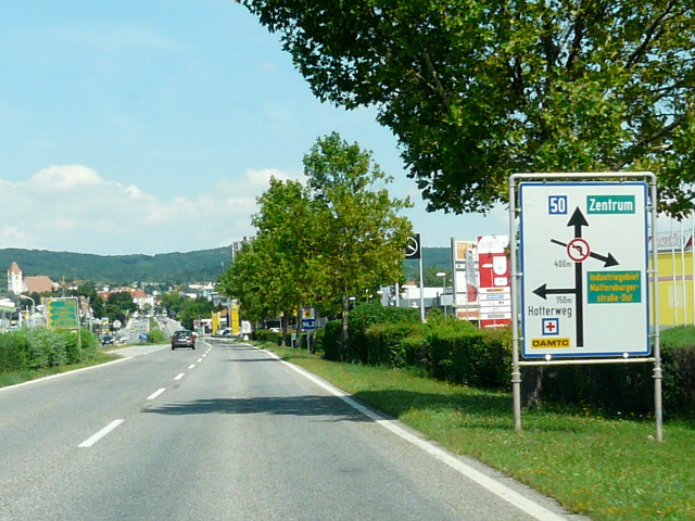 | 3.
Foto gemaakt in augustus 2016 P1260304x50 Op de foto: 50 ⇈top⇈ |
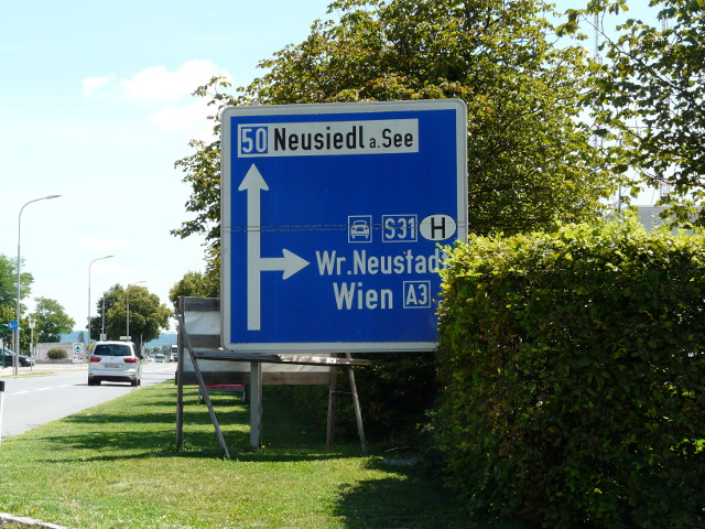 | 4.
Foto gemaakt in augustus 2016 P1260307x50s31a3 Op de foto: 50 S31 A3 ⇈top⇈ |
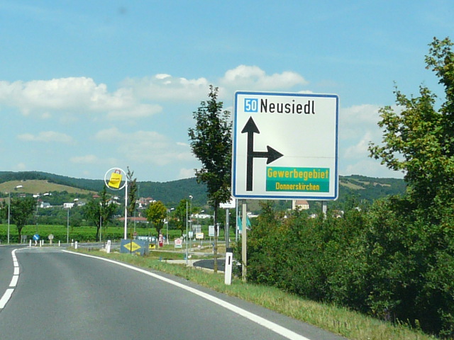
 | 5.
Foto gemaakt in augustus 2016 P1260308x50omlegging Op de foto: 50 Een nieuwe dorpsomlegging ⇈top⇈ |
 | 6.
Foto gemaakt in augustus 2016 P1260312x50 Op de foto: 50 ⇈top⇈ |
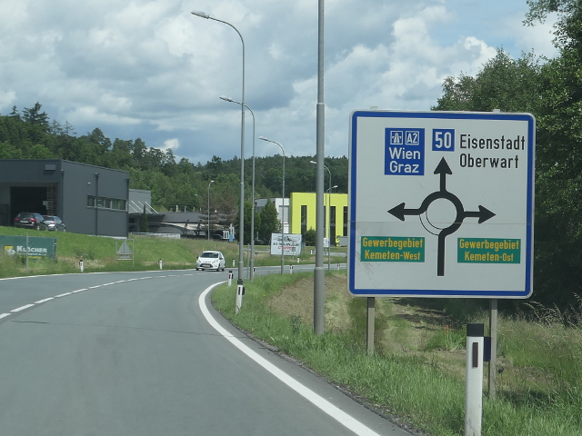
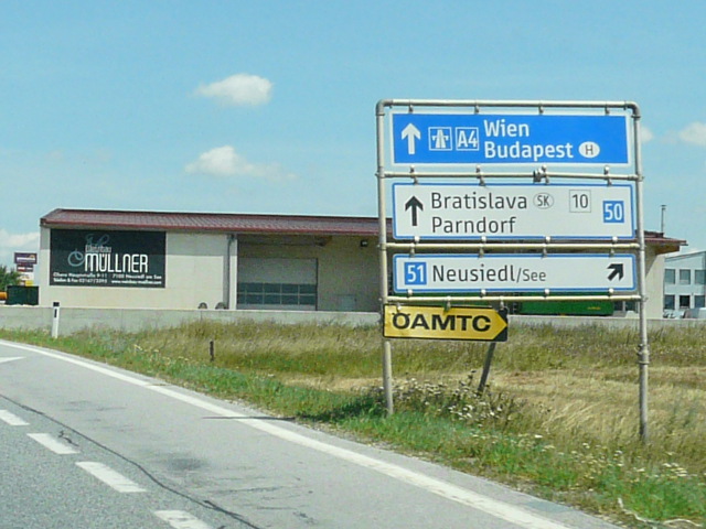 | 7.
Foto gemaakt in augustus 2016 P1260318x50x51a4x10 Op de foto: 50 51 A4 10 ⇈top⇈ |
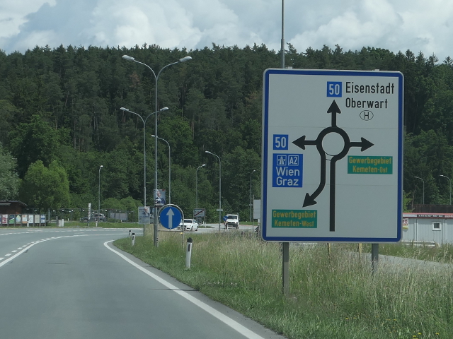
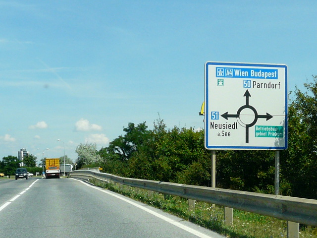 | 8.
Foto gemaakt in augustus 2016 P1260319x50x51a4 Op de foto: 50 51 A4 ⇈top⇈ |
 | 9.
Foto gemaakt in mei 2024 P1280381b50a2 Op de foto: 50 A2 ⇈top⇈ |
 | 10.
Foto gemaakt in mei 2024 P1280383b50a2 Op de foto: 50 A2 ⇈top⇈ |
| B 50a | Burgenland Straße: Wolfsthal-Kittsee |
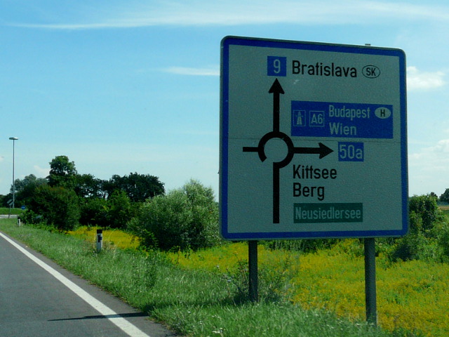 | 11.
Foto gemaakt in augustus 2016 P1260337x50ax9a6 Op de foto: 50a 9 A6 ⇈top⇈ |
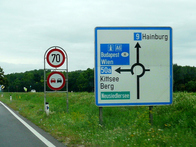 | 12.
Foto gemaakt in augustus 2016 P1260430x50ax9a6 Op de foto: 50a 9 A6 ⇈top⇈ |
| B 51 | Neusiedler Straße: Neusiedl am See-Pamhagen-Staatsgrenze zu Ungarn |
| B 52 | Ruster Straße: Eisenstadt-Mörbisch |
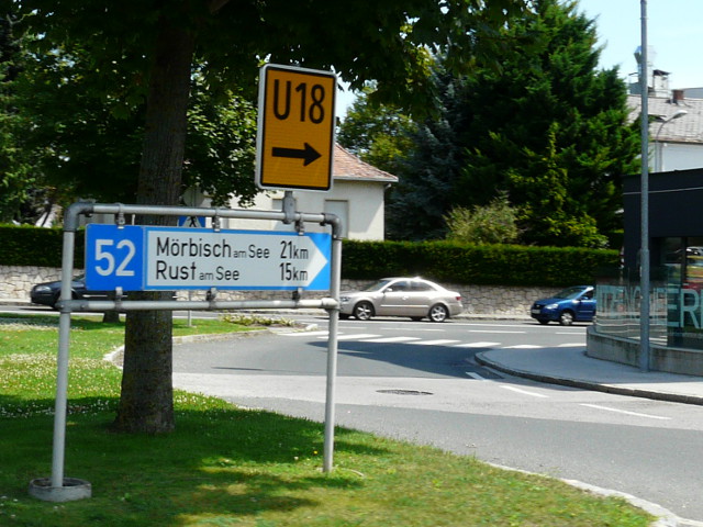 | 13.
Foto gemaakt in augustus 2016 P1260306x52 Op de foto: 52 ⇈top⇈ |
| B 53 | Pöttschinger Straße: Wiener Neustadt-Zemendorf, früher S 4 |
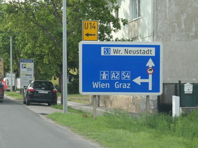
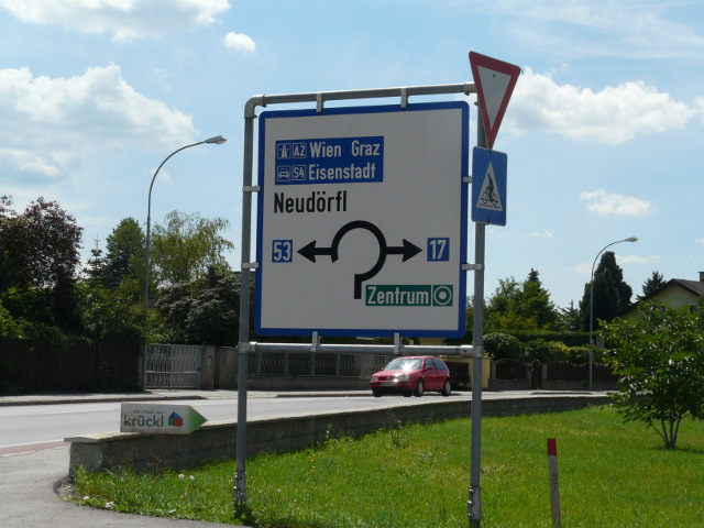 | 14.
Foto gemaakt in augustus 2016 P1260294x53x17a2s4 Op de foto: 53 17 A2 S4 ⇈top⇈ |
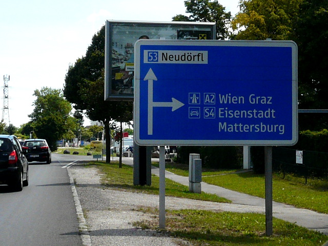 | 15.
Foto gemaakt in augustus 2016 P1260295x53a2s4 Op de foto: 53 A2 S4 ⇈top⇈ |
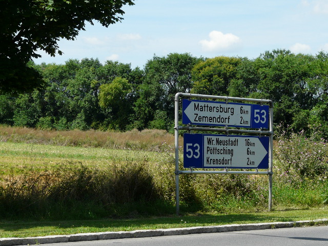 | 16.
Foto gemaakt in augustus 2016 P1260296x53 Op de foto: 53 ⇈top⇈ |
 | 17.
Foto gemaakt in mei 2024 P1280419b53a2s4 Op de foto: 53 A2 S4 ⇈top⇈ |
| B 54 | Wechsel Straße: Wiener Neustadt-Aspang-Wechselpass-Hartberg-Gleisdorf-Ludersdorf-Wilfersdorf |
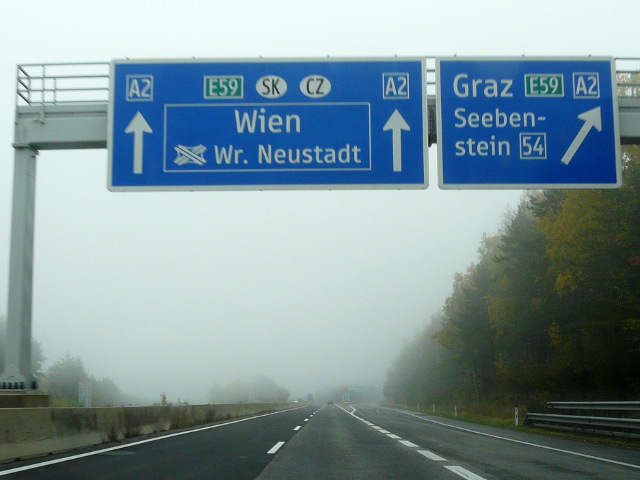 | 18.
Foto gemaakt in oktober 2016 P1290204b54a2e59 Op de foto: 54 A2 E59 ⇈top⇈ |
| B 55 | Kirchschlager Straße: Grimmenstein-Rattersdorf |
| B 56 | Geschriebenstein Straße: Lockenhaus-Güssing |
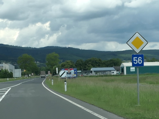 | 19.
Foto gemaakt in mei 2024 P1280399b56 Op de foto: 56 ⇈top⇈ |
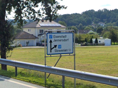
| B 57 | Güssinger Straße: Oberwart-Güssing-Jennersdorf-Feldbach |
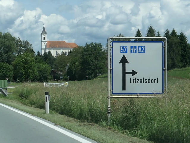
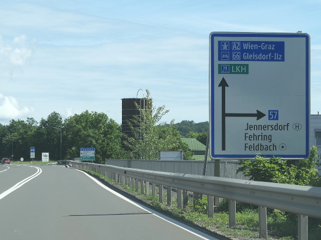 | 20.
Foto gemaakt in mei 2024 P1280356b57a2b66 Op de foto: 57 A2 66 ⇈top⇈ |
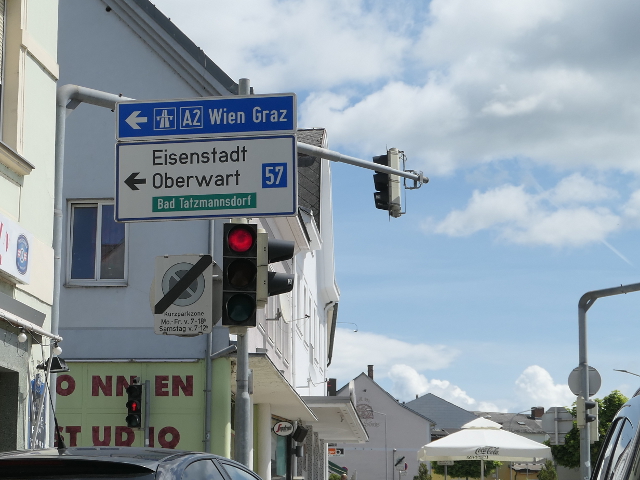
 | 21.
Foto gemaakt in mei 2024 P1280357b57a2 Op de foto: 57 A2 ⇈top⇈ |
 | 22.
Foto gemaakt in mei 2024 P1280378b57a2 Op de foto: 57 A2 ⇈top⇈ |
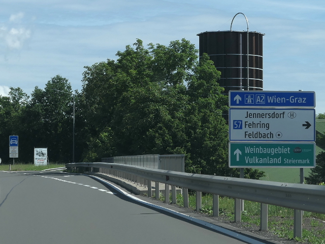
 | 23.
Foto gemaakt in mei 2024 P1280379b57a2 Op de foto: 57 A2 ⇈top⇈ |
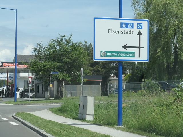
 | 24.
Foto gemaakt in mei 2024 P1280380b57a2 Op de foto: 57 A2 ⇈top⇈ |
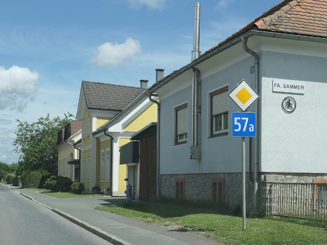
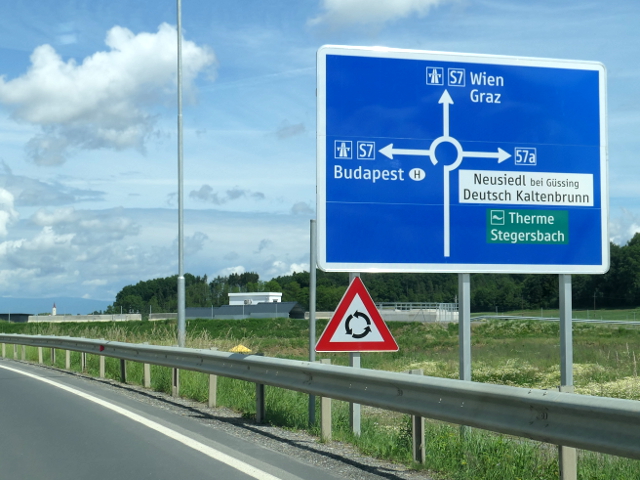
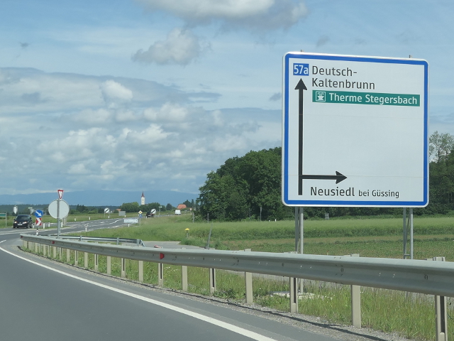
| B 57a | Stegersbacher Straße: Stegersbach-Rudersdorf |
 | 25.
Foto gemaakt in mei 2024 P1280374b57a Op de foto: 57a ⇈top⇈ |
 | 26.
Foto gemaakt in mei 2024 P1280376b57as7 Op de foto: 57a S7 ⇈top⇈ |
 | 27.
Foto gemaakt in mei 2024 P1280377b57a Op de foto: 57a ⇈top⇈ |
| B 58 | Doiber Straße: Doiber-Bonisdorf-Staatsgrenze zu Slowenien |
 | 28.
Foto gemaakt door Google Streetview at058_gm Op de foto: 58 ⇈top⇈ |
| B 59 | Eisenstädter Straße: Großhöflein-Eisenstadt |
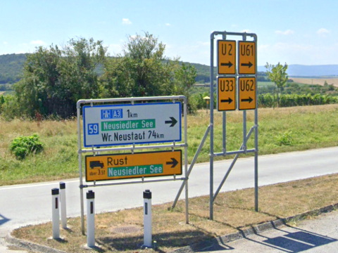 | 29.
Foto gemaakt door Google Streetview at059_gm Op de foto: 59 ⇈top⇈ |
| B 60 | Leitha Straße: Wiener Neustadt-Fischamend |
 | 30.
Foto gemaakt in augustus 2016 P1260293x60x17 Op de foto: 60 17 ⇈top⇈ |
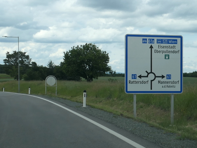
| B 61 | Günser Straße: Steinberg-Dörfl (S 31, B 50)-Unterpullendorf-Staatsgrenze zu Ungarn bei Rattersdorf |
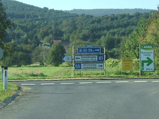 | 31.
Foto gemaakt in 2010 door Marcel Monterie B61_south_120_DSCF46101_20100921 Op de foto: 61 55 A2 ⇈top⇈ |
| B 61a |
 | 32.
Foto gemaakt in mei 2024 P1280403b61as31b61 Op de foto: 61a S31 61 ⇈top⇈ |
| B 62 | Deutschkreutzer Straße: Weppersdorf (S 31)-Horitschon-Staatsgrenze zu Ungarn bei Deutschkreutz |
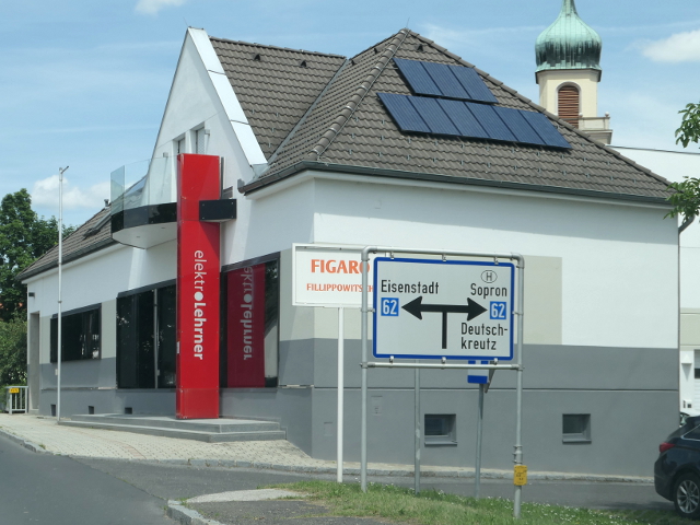 | 33.
Foto gemaakt in mei 2024 P1280405b62 Op de foto: 62 ⇈top⇈ |
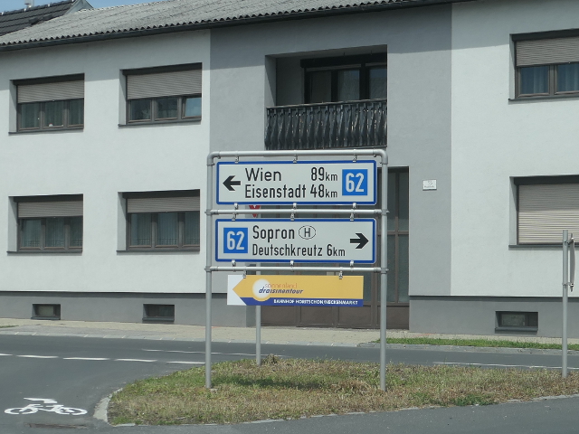 | 34.
Foto gemaakt in mei 2024 P1280406b62 Op de foto: 62 ⇈top⇈ |
| B 63 | Steinamangerer Straße: Pinggau-Oberwart-Staatsgrenze zu Ungarn bei Schachendorf |
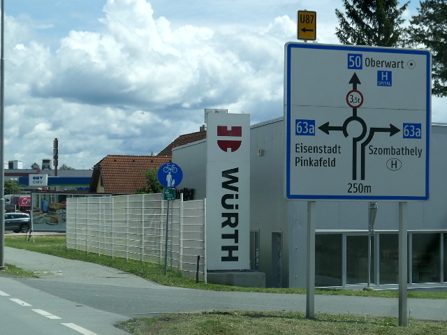
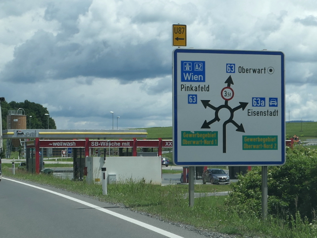 | 35.
Foto gemaakt in mei 2024 P1280389b63b63aa2 Op de foto: 63 63a A2 ⇈top⇈ |
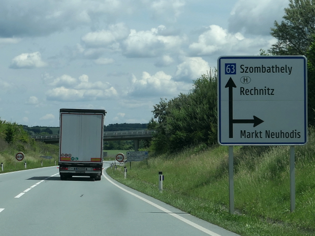 | 36.
Foto gemaakt in mei 2024 P1280394b63 Op de foto: 63 ⇈top⇈ |
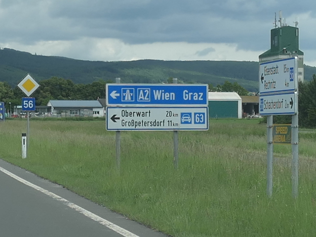
 | 37.
Foto gemaakt in mei 2024 P1280396b63b56 Op de foto: 63 56 ⇈top⇈ |
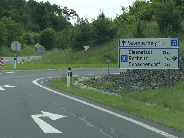 | 38.
Foto gemaakt in mei 2024 P1280397b63b56 Op de foto: 63 56 ⇈top⇈ |
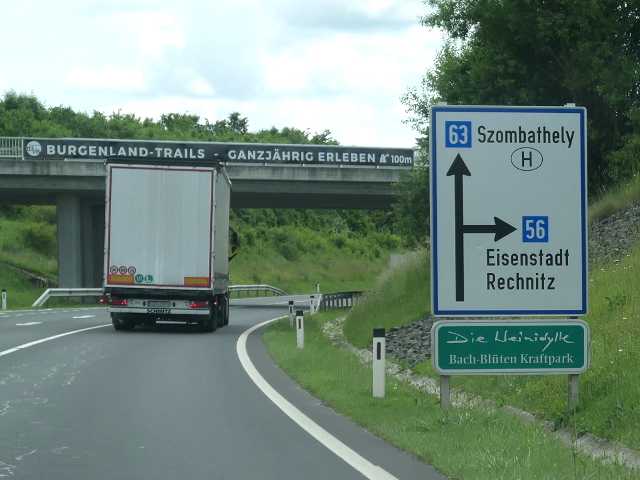
 | 39.
Foto gemaakt in mei 2024 P1280398b63a2 Op de foto: 63 A2 ⇈top⇈ |
| B 63a | Oberwarter Straße: Oberwart (Umfahrung) |
 | 40.
Foto gemaakt in mei 2024 P1280386b63ab50 Op de foto: 63a 50 ⇈top⇈ |
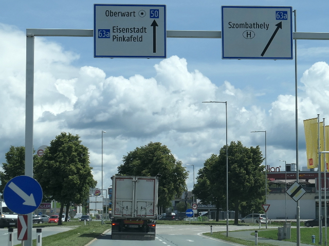 | 41.
Foto gemaakt in mei 2024 P1280387b63ab50 Op de foto: 63a 50 ⇈top⇈ |
| B 64 | Rechberg Straße: Gleisdorf-Weiz-Frohnleiten |
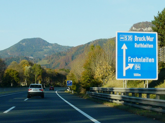 | 42.
Foto gemaakt in oktober 2016 P1290159b64s35 Op de foto: 64 S35 ⇈top⇈ |
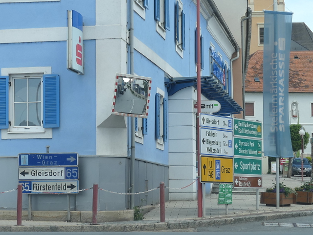
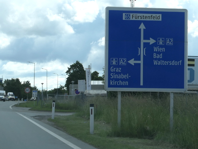
| B 65 | Gleisdorfer Straße: Graz-Gleisdorf-Ilz-Fürstenfeld-Staatsgrenze zu Ungarn bei Heiligenkreuz |
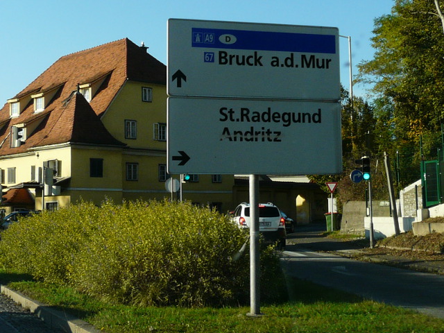
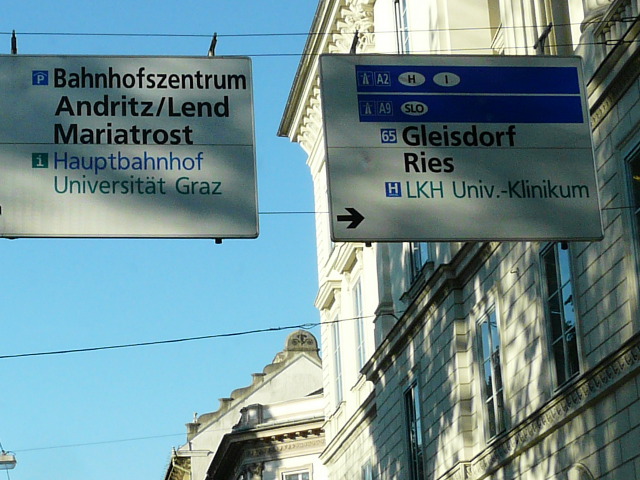 | 43.
Foto gemaakt in oktober 2016 P1290143b65a2a9 Op de foto: 65 A2 A9 ⇈top⇈ |
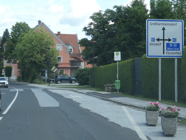 | 44.
Foto gemaakt in mei 2024 P1280364b65a2 Op de foto: 65 A2 ⇈top⇈ |
 | 45.
Foto gemaakt in mei 2024 P1280365b65 Op de foto: 65 ⇈top⇈ |
 | 46.
Foto gemaakt in mei 2024 P1280367b65a2 Op de foto: 65 A2 ⇈top⇈ |
 | 47.
Foto gemaakt in mei 2024 P1280372b65e66b57as7 Op de foto: 65 E66 57 S7 ⇈top⇈ |
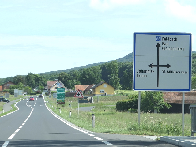
| B 66 | Gleichenberger Straße: Ilz-Feldbach-Halbenrain |
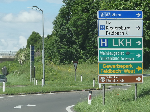
 | 48.
Foto gemaakt in mei 2024 P1280352b66 Op de foto: 66 ⇈top⇈ |
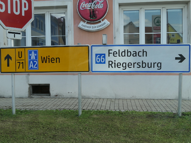
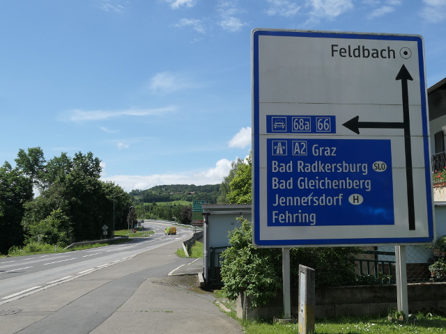
 | 49.
Foto gemaakt in mei 2024 P1280359b66b68a2 Op de foto: 66 68 A2 ⇈top⇈ |
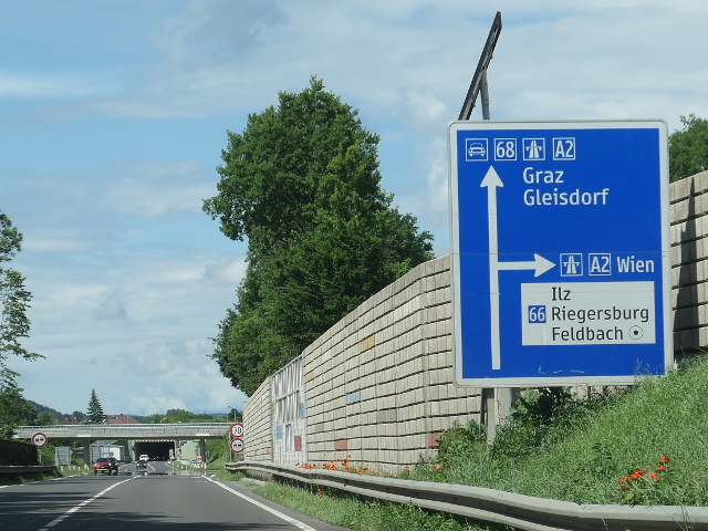
 | 50.
Foto gemaakt in mei 2024 P1280360b66a2route66 Op de foto: 66 A2 ⇈top⇈ |
 | 51.
Foto gemaakt in mei 2024 P1280366b66a2 Op de foto: 66 A2 ⇈top⇈ |
| B 67 | Grazer Straße: Bruck an der Mur-Staatsgrenze zu Slowenien bei Spielfeld |
 | 52.
Foto gemaakt in oktober 2016 P1290147b67a9 Op de foto: 67 A9 ⇈top⇈ |
 | 53.
Foto gemaakt in oktober 2016 P1290150b67a2a9 Op de foto: 67 A2 A9 ⇈top⇈ |
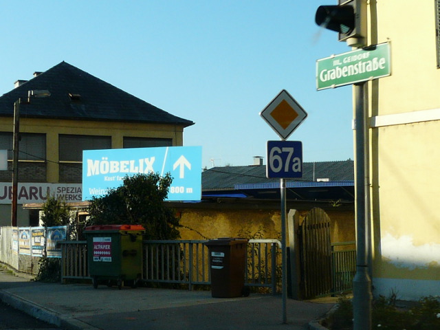
| B 67a | Grazer Ring Straße: Graz Andritz-Graz-Webling |
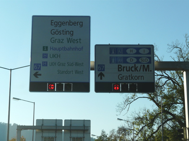
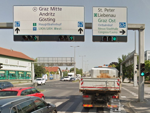
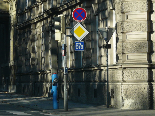 | 54.
Foto gemaakt in oktober 2016 P1290144b67a Op de foto: 67a ⇈top⇈ |
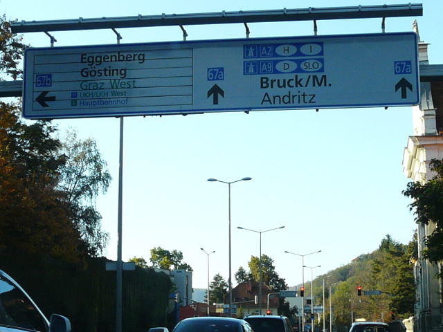 | 55.
Foto gemaakt in oktober 2016 P1290146b67ab67ba2a9 Op de foto: 67a 67b A2 A9 ⇈top⇈ |
 | 56.
Foto gemaakt in oktober 2016 P1290148b67a Op de foto: 67a ⇈top⇈ |
| B 67b | Kalvariengürtel Straße: Graz Kalvariengürtel-Graz Grabengürtel |
| B 67c | Waltendorfer Straße: Graz Karlauer Gürtel-Graz Waltendorf |
 | 57.
Foto gemaakt door Google Streetview at067c_gm Op de foto: 67c ⇈top⇈ |
| B 68 | Feldbacher Straße: Gleisdorf-Feldbach |
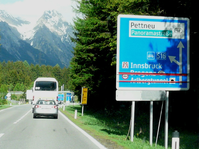 | 58.
Foto gemaakt in mei 2017 P1320779atx68s16 Op de foto: 68 S16 ⇈top⇈ |
| B 68a |
 | 59.
Foto gemaakt in mei 2024 P1280361b68ab66a2 Op de foto: 68a 66 A2 ⇈top⇈ |
| B 69 | Südsteirische Grenz Straße: Lavamünd-Staatsgrenze zu Slowenien bei Bad Radkersburg |
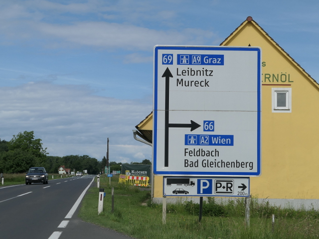 | 60.
Foto gemaakt in mei 2024 P1280350b69b66a9a2 Op de foto: 69 66 A9 A2 ⇈top⇈ |
| B 70 | Packer Straße: Graz-Klagenfurt |
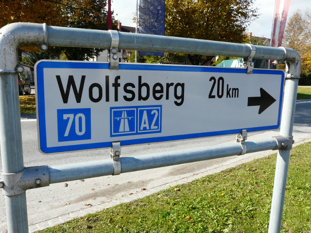 | 61.
Foto gemaakt in oktober 2016 P1290009b70a2 Op de foto: 70 A2 ⇈top⇈ |
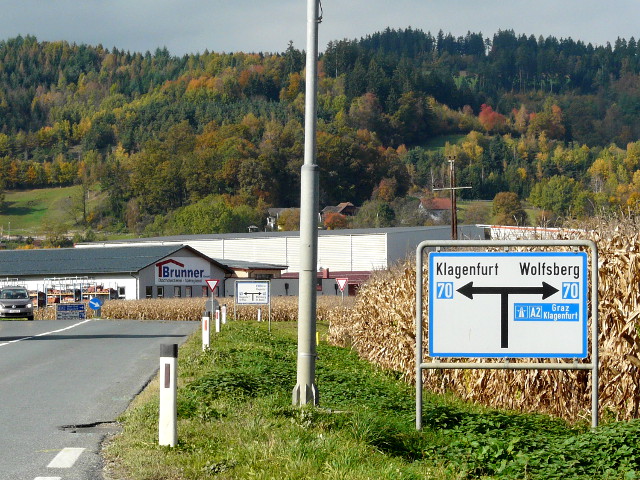 | 62.
Foto gemaakt in oktober 2016 P1290014b70a2 Op de foto: 70 A2 ⇈top⇈ |
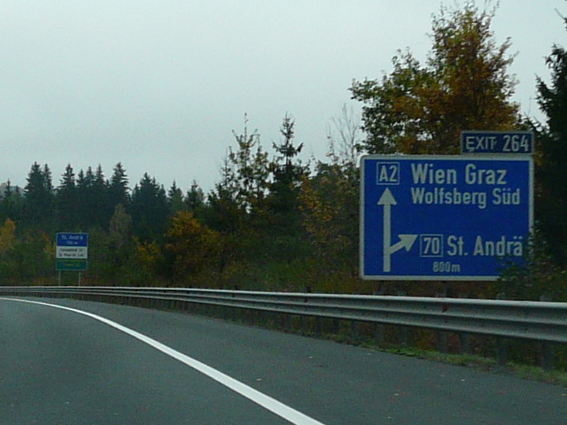 | 63.
Foto gemaakt in oktober 2016 P1290060b70a2 Op de foto: 70 A2 ⇈top⇈ |
| B 70a | Packer Straße, Abzweigung Wolfsberg/Süd |
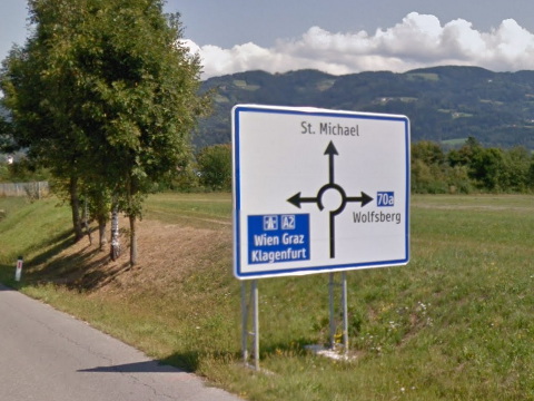 | 64.
Foto gemaakt door Google Streetview at070a_gm Op de foto: 70a ⇈top⇈ |
| B 70b | Packer Straße, Abzweigung Wolfsberg/Nord |
| Status: | Het wegnummer is nergens op de weg zelf zichtbaar. |
| B 71 | Zellerrain Straße: Grubberg-Mariazell |
| B 72 | Weizer Straße: Graz-Weiz-Krieglach |
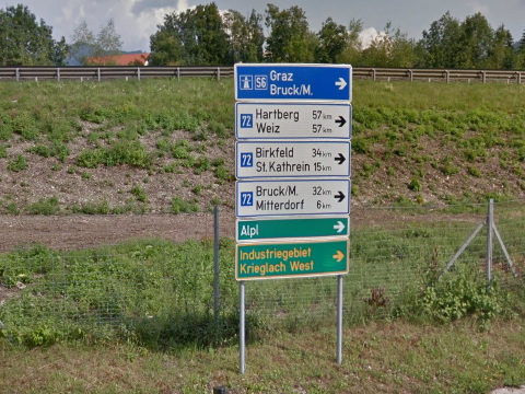 | 65.
Foto gemaakt door Google Streetview at072_gm Op de foto: 72 ⇈top⇈ |
| B 73 | Kirchbacher Straße: Graz/Liebenau (A 2)-Hausmannstätten-Kirchbach-Neugralla (B 67) |
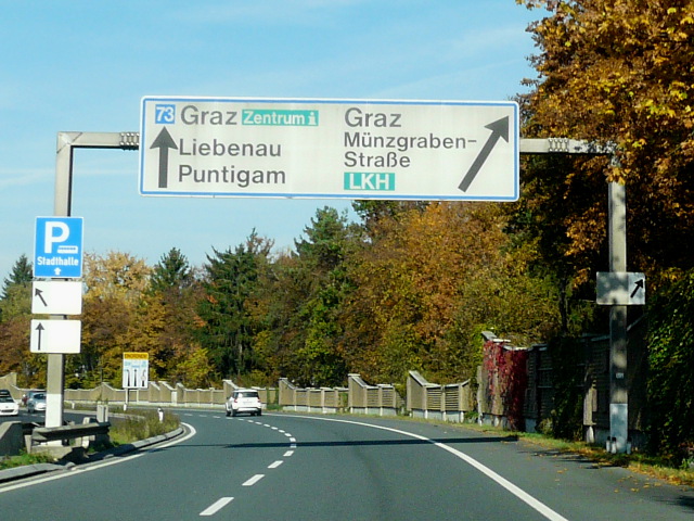 | 66.
Foto gemaakt in oktober 2016 P1290073b73 Op de foto: 73 ⇈top⇈ |
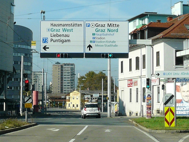 | 67.
Foto gemaakt in oktober 2016 P1290075b73 Op de foto: 73 ⇈top⇈ |
| B 74 | Sulmtal Straße: Anschlussstelle Leibnitz (A 9) bei Gralla-Deutschlandsberg (B 76) |
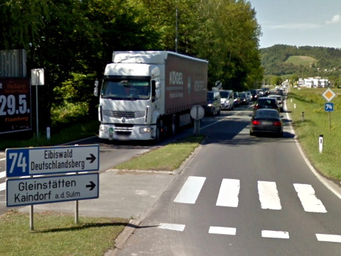 | 68.
Foto gemaakt door Google Streetview at074_gm Op de foto: 74 ⇈top⇈ |
| B 75 | Glattjoch Straße: Neuhaus (B 145, B 320)-Glattjoch-Oberwölz-Niederwölz (B 96) |
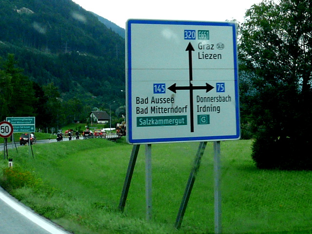 | 69.
Foto gemaakt in augustus 2016 P1260232x75x320x145 Op de foto: 75 320 145 ⇈top⇈ |
| B 76 | Radlpass Straße: Lieboch (B 70)-Staatsgrenze zu Slowenien am Radlpass |
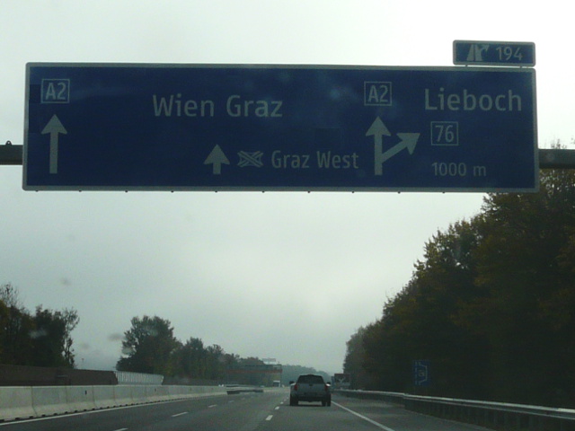 | 70.
Foto gemaakt in oktober 2016 P1290062b76a2 Op de foto: 76 A2 ⇈top⇈ |
| B 77 | Gaberl Straße: Judenburg (S 36)-Weißkirchen-Gaberl-Köflach (B 70) |
 | 71.
Foto gemaakt door Google Streetview at077at078_gm Op de foto: 77 78 ⇈top⇈ |
| B 78 | Obdacher Straße: Twimberg (Packer Straße)-Bad St. Leonhard im Lavanttal-Zeltweg |
| << Vorige pagina | (Deze pagina is gegenereerd door AweGen 5.19 op 2025-08-20) | Volgende pagina >> |